|
|
| Line 1: |
Line 1: |
| {{Infobox Settlement | | {| class="infobox settlement" style="width: 25em; text-align: left; font-size: 95%;" |
| |official_name = City of St. John's | | |+ style="font-size: larger;" | '''Rail Driver''' |
| |nickname = "The City of Legends" | | |- |
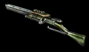
| |motto = ''Avancez'' ("Go forward") | | | colspan="2" style="text-align:center;" | [[Image:Rail.jpg|300px| ]]<br>Rail Driver (FCA-26 Magnetic Rail Driver) |
| |image_skyline = Stjohnsnewfoundland.jpg
| | |- |
| |imagesize =
| | ! Data 1: |
| |image_caption = Downtown St. John's
| | | {{{data1}}} |
| |image_flag =
| | |- |
| |image_seal = Stjohnsnewfoundlandcrest.jpg
| | ! Data 2: |
| |pushpin_map = Newfoundland
| | | {{{data2|''this text displayed if data2 not defined''}}} |
| |pushpin_label_position = none
| | |- |
| |pushpin_map_caption = Location of St. John's in Newfoundland
| | ! Data 3 (data hidden if data3 empty or not defined): |
| |subdivision_type = Country | | | {{{data3|}}} |
| |subdivision_name = Canada | | |- |
| |subdivision_type1 = [[Provinces of Canada|Province]]
| | | colspan="2" style="font-size: smaller;" | {{{footnotes|}}} |
| |subdivision_name1 = [[Newfoundland and Labrador]]
| | |} |
| |leader_title = City Mayor
| |
| |leader_title1 = Governing body
| |
| |leader_title2 = [[Canadian House of Commons|MPs]] | |
| |leader_title3 = [[Legislative Assembly|MHAs]] | |
| |leader_name = <nowiki>Dennis O'Keefe</nowiki> (Acting)
| |
| |leader_name1 = [[St. John's City Council]] | |
| |leader_name2 = [[List of MPs and MLAs from St. John's, Newfoundland and Labrador|List of St. John's MPs]]
| |
| |leader_name3 = [[List of MPs and MLAs from St. John's, Newfoundland and Labrador|List of St. John's MHAs]]
| |
| |established_title = Established
| |
| |established_date = [[August 5]], [[1583]] by [[Royal Prerogative|Royal Charter]] of [[Elizabeth I of England|Queen Elizabeth I]]
| |
| |area_magnitude =
| |
| |area_footnotes =
| |
| |area_total_km2 = 446.04 <!--Statistics Canada-->
| |
| |area_total_sq_mi = 172.2
| |
| |area_land_km2 =
| |
| |area_land_sq_mi =
| |
| |area_water_km2 =
| |
| |area_water_sq_mi =
| |
| |area_water_percent =
| |
| |area_urban_km2 =
| |
| |area_urban_sq_mi =
| |
| |area_metro_km2 = 804.63 <!--Statistics Canada-->
| |
| |area_metro_sq_mi = 310.7
| |
| |population_as_of = [[2006]]
| |
| |population_note = [[List of the 100 largest metropolitan areas in Canada|20th Largest metropolitain area in Canada]]
| |
| |population_total = 100,646
| |
| |population_density_km2 = 225.6
| |
| |population_density_sq_mi = 576.0
| |
| |population_metro = 181,113
| |
| |population_density_metro_km2 =225.1
| |
| |population_density_metro_sq_mi =556.6 | |
| |population_urban =
| |
| |timezone = [[Newfoundland Standard Time Zone|NST]] | |
| |utc_offset = -3:30
| |
| |timezone_DST = NDT
| |
| |utc_offset_DST = -2:30
| |
| |latd=47 |latm=33 |lats=32.4 |latNS=N | |
| |longd=52 |longm=42 |longs=46.8 |longEW=W
| |
| |elevation_m = Sea Level 0 -147 | |
| |elevation_ft = 0 - 483
| |
| |area_code = [[Area code 709|709]] | |
| |blank_name = [[National Topographic System|NTS]] Map | |
| |blank_info = 001N10 | |
| |blank1_name = [[Geographical Names Board of Canada|GNBC]] Code
| |
| |blank1_info = ABEFS | |
| |website = [http://www.stjohns.ca/index.jsp St. John's website] | |
| |footnotes =
| |
| }}
| |
